IOCCG news bulletins include items of interest from the IOCCG, its sponsoring agencies, as well as the broader ocean colour community (including new publications). Please let us know if there are any other items of interest you would like to see included in the next IOCCG news bulletin (contact Raisha Lovindeer). You can also follow IOCCG on Twitter.
IOCCG News
Trevor Platt Memorial Scholarship Deadline Extended
Submission of applications for two Trevor Platt Memorial Scholarships for 2023 has been extended to January 13, 2023. The Scholarship for ocean colour research and training, aims to provide students and early career scientists from developing countries or economies in transition with the opportunity to gain valuable experience in ocean colour remote sensing and applications. Graduate students and early career scientists (within 5 years from a PhD) from any of these eligible countries are encouraged to apply. For more details and to apply see the link on the IOCCG website: https://ioccg.org/what-we-do/training-and-education/platt-scholarship.
2022 Summer Lecture Series Material Available
Lecture slides and video recordings are now available for the successful 5th IOCCG Summer Lecture Series (SLS), Frontiers in Ocean Optics and Ocean Colour Science. The 2022 SLS was recently hosted by the Institut de la Mer de Villefranche (IMEV) in Villefranche-sur-Mer, France (18 – 29 July 2022). Access the lecture slides and video recordings on the IOCCG website at: https://ioccg.org/what-we-do/training-and-education/ioccg-sls-2022/. This is an excellent resource on a range of ocean colour topics and we thank all the energetic lecturers who volunteered their time to teach at this event.
Save the Dates for the 5th IOCS Meeting
![]() The fifth International Ocean Colour Science (IOCS) meeting will take place from 14-17 November 2023 in St. Petersburg, FL, USA, and will be convened by the International Ocean Colour Coordinating Group (IOCCG) in partnership with the University of South Florida, NASA, and NOAA. The primary focus of the IOCS meetings is to serve as a venue for the ocean colour community to communicate their views, ideas, concerns and issues with the satellite agencies. The programme for the IOCS-2023 meeting will include invited keynote lectures, agency talks, breakout workshops, poster sessions and community Town Halls. It is anticipated that training events and side meetings will also be scheduled.
The fifth International Ocean Colour Science (IOCS) meeting will take place from 14-17 November 2023 in St. Petersburg, FL, USA, and will be convened by the International Ocean Colour Coordinating Group (IOCCG) in partnership with the University of South Florida, NASA, and NOAA. The primary focus of the IOCS meetings is to serve as a venue for the ocean colour community to communicate their views, ideas, concerns and issues with the satellite agencies. The programme for the IOCS-2023 meeting will include invited keynote lectures, agency talks, breakout workshops, poster sessions and community Town Halls. It is anticipated that training events and side meetings will also be scheduled.
The overarching theme for IOCS-2023 is “Impact and Value of Ocean Colour Observations in a Changing World: Water in all its Colours” with the overall goal of nurturing a strong global user community for ocean colour science and applications, and fostering exchange between the ocean colour research community and international space agencies with an interest in ocean colour science. Please consult the meeting website https://iocs.ioccg.org/ for further details. Registration for the event will open in March next year.
New Aquatic Primary Production Protocols
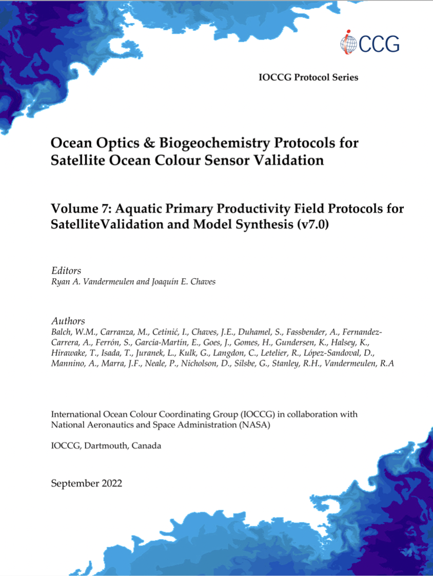 A new protocol for measuring aquatic primary productivity (PP) has been published in the IOCCG Protocol Series. This volume is edited by Ryan Vandermeulen and Joaquín Chaves, with inputs from 27 authors. The measurement of aquatic PP is central to the quantitative understanding of the global biosphere. It yields critical insights into the role and magnitude of carbon, oxygen, and other bioactive element fluxes between the ocean, the geosphere, and the atmosphere. This work represents the most comprehensive guide to field measurements of aquatic PP (and respiration) to date, and should be widely adopted by the scientific community engaged in ocean carbon research, particularly those in activities that support ocean colour validation.
The accumulation of theoretical, methodological, and technological advances has led to the development of numerous approaches to measure oceanic PP, all with the common objective of quantifying the fluxes of reduced carbon into aquatic ecosystems. Methods to derive estimates of PP include: the analysis of incubations to measure dissolved oxygen gas accumulation and consumption; radioactive 14C, stable 13C, and 18O uptake; isotopic composition of atmospheric and dissolved oxygen; underway measurements of O2/Ar, kinetic measurements of variable chlorophyll fluorescence, and temporally and spatially integrated time series from gliders or buoys. Integrating these measurements with satellite observations of ocean biomass and its physical environment enable the scaling up of PP data into a comprehensive, global picture. The main goal for these PP protocols is to establish a set of best practices across multiple methods for measuring aquatic primary productivity, in an effort to constrain systematic and random measurement biases. Through a better understanding of the different capabilities, assumptions, and limitations inherent to each measurement, users may leverage the assets and liabilities of each method in the context of satellite validation and model synthesis. Download: Aquatic Primary Productivity Field Protocols for Satellite Validation and Model Synthesis (vol. 7.0).
News from NASA
NASA PACE Community Newsletter
Keep up with the NASA Plankton, Aerosol, Cloud, ocean Ecosystem (PACE) Mission via its second quarterly Community Newsletter. To join the PACE Community of Practice, see here: https://pace.oceansciences.org/app_community.htm
PACE Applications Workshop
 On September 14-15, the PACE mission hosted its 3rd PACE Applications Workshop. Nearly 1000 participants from over 80 countries registered to hear the latest about the PACE Mission, science, and societal applications. This event focused on future uses of PACE satellite data, research, and applications to benefit society and support decision-making in the context of water resources, air quality and health, climate, disasters, and ecological forecasting. You can view the session recordings online at: https://pace.oceansciences.org/event_archive/applications_workshop_2022.htm
GLIMR Applications Workshop
![]() The 1st GLIMR Applications Workshop was held virtually on 16 September 2022, and was a successful event with high engagement from participants. People across the world from different sectors and with expertise across a wide range of disciplines discussed and learned more about NASA’s first geostationary ocean color mission. Live session recordings are now available on the GLIMR Applications webpage at https://eos.unh.edu/glimr/events
The 1st GLIMR Applications Workshop was held virtually on 16 September 2022, and was a successful event with high engagement from participants. People across the world from different sectors and with expertise across a wide range of disciplines discussed and learned more about NASA’s first geostationary ocean color mission. Live session recordings are now available on the GLIMR Applications webpage at https://eos.unh.edu/glimr/events
If you would like to learn more about how to participate in the preparation efforts for GLIMR and become an Early Adopter, please contact Maria Tzortziou at maria.a.tzortziou@nasa.gov
News from NOAA
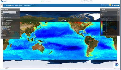
NOAA MSL12 multi-sensor DINEOF global gap-filled products: Chlorophyll-a, diffuse attenuation coefficient Kd(490), and suspended particulate matter (SPM)
Multi-sensor 9 km gap-filled, global ocean colour products are now available on the NOAA CoastWatch data portal and ERDDAP. This product is generated from inputs from 3 instruments: the VIIRS sensors aboard both SNPP and NOAA-20, plus the OLCI on Sentinel 3A. The VIIRS Level-1B data are provided by NOAA, JPSS and the OLCI Level-1B data are from EUMETSAT. The NOAA/STAR Ocean Color Team then produces science quality analysis products on a ~10 day delay based on the NOAA Multi-Sensor Level-1 to Level-2 (MSL12) processing system for chlorophyll-a, light attenuation (downwelling) coefficients at 490 nm (Kd490), and Suspended Particulate Material (SPM). This data collection extends back to 2018, which is the beginning of NOAA-20 data. Click here for detailed product description (click the description tab) and data access links (click the access tab). To view and download product data you can also access through the NOAA CoastWatch data portal here (as shown in Figure below).
NOAA Coastwatch Annual Science Meeting
The NOAA CoastWatch Annual Science Meeting will be held May 22-25, 2023 in Honolulu, HI, hosted by the OceanWatch Central Pacific Node (housed in the NOAA/NMFS Pacific Islands Fisheries Science Center) at the University of Hawaii campus. This meeting will feature Central Pacific Node stakeholders and associated research, applications development, and products tailored to meet user needs.
News from EUMETSAT
Copernicus Sentinel-3 OLCI Ocean Colour Time Series
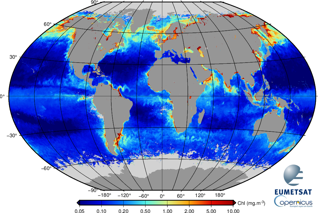 The EUMETSAT Data Store has become a single online access point to the full Sentinel-3 OLCI L2 Ocean Colour archive for all reprocessed and operational data. The Data Store is now distributing a consistent OLCI time series processed with Collection-3 algorithms. Historical CODA and CODArep services have been discontinued. Operational L1 data and those from past reprocessings are also available, with the full archive to follow with the future L1 reprocessing. The collections can be accessed via the Data Store web GUI and using the APIs. EUMETSAT has provided an API client (EUMDAC) to support use of the APIs. It is available as a command line interface and a Python package. Details of the Data Store collections and how to access the full L2 archive via the associated tools are available in an online FAQ. User helpdesk: ops@eumetsat.int
EUMETSAT is also developing tools for users for ocean colour validation to seamlessly download OLCI products, extract mini-files and perform matchups with in situ measurements using standard or modified protocols. Python scripts in preview version, pending software quality assurance, are available here for testing and feedback. Point of contact: JuanIgnacio.Gossn@eumetsat.int.
FRM4SOC-2 Workshop 5 – 7 December 2022: Registration deadline 20 November
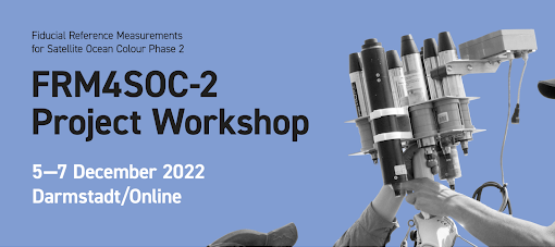 The Fiducial Reference Measurements for Satellite Ocean Colour (FRM4SOC) Phase 2 Project Workshop will be held from 5 to 7 December 2022 in Darmstadt, Germany, and online. FRM4SOC-2 has been developing tools, procedures and guidelines for in situ radiometers and measurements to support the community in collecting FRM-quality measurements. FRM4SOC-2 is founded on the existing wealth of community and agency FRM developments, including the IOCCG protocols. FRM4SOC-2 achievements include measurement uncertainty budget propagation based on detailed calibration and characterisation of the radiometers, prescriptive measurement procedures, and standardised data processing in a community processor.
Anybody interested in the FRM-quality of in situ radiometric measurements, and the related satellite ocean colour product-quality reporting, is highly encouraged to attend and contribute to the Workshop reviews, discussions and community recommendations. The draft agenda is available online. Registration for the Workshop is open until 20 November 2022
News from GEO AquaWatch
Join the AquaWatch Nomenclature Focus Group
![]() The GEO AquaWatch Nomenclature Focus Group is a community lead initiative to build a free, online, machine readable, and versioned resource consolidating and harmonizing terminology in hydrologic optics and aquatic remote sensing. It will include concepts from related fields from which we heavily borrow from (e.g. physics, statistics) or closely interact with (e.g. biology, chemistry). It will revisit terminology, symbols and definitions, but has also as its main goal to consolidate the information in a single reference document and provide content focused on helping proper interpretation of concepts, quantities and estimations.
The GEO AquaWatch Nomenclature Focus Group is a community lead initiative to build a free, online, machine readable, and versioned resource consolidating and harmonizing terminology in hydrologic optics and aquatic remote sensing. It will include concepts from related fields from which we heavily borrow from (e.g. physics, statistics) or closely interact with (e.g. biology, chemistry). It will revisit terminology, symbols and definitions, but has also as its main goal to consolidate the information in a single reference document and provide content focused on helping proper interpretation of concepts, quantities and estimations.
This resource is intended to help keep consistent terminology within the field, and between fields from which some concepts we use originate, and to bridge the jargon and knowledge barrier for early career researchers, researchers from closely related fields and stakeholders. The group is open to all members of this community and is reaching out to specialists in related fields (biology, statistics, etc). For more information see the group’s webpage. To join this initiative, send an email to alexandre.castagna@eoplus.science and daniela.gurlin@hotmail.com.
GEO AquaWatch Webinars on Aquatic Remote Sensing
GEO AquaWatch hosts a series of webinars on the application of remote sensing to the management of water quality. Check their line-up of future webinars at the following link: https://www.geoaquawatch.org/future-geo-aquawatch-webinars/
Upcoming Events
Call for Abstracts: International Operational Satellite Oceanography Symposium (OSOS-3)
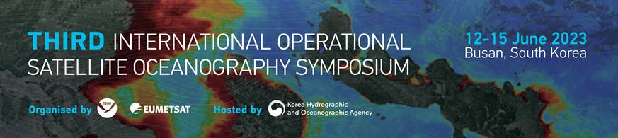
The Executive Steering Committee and Scientific Programme Committee are pleased to invite you to submit an abstract for the Third International Operational Satellite Oceanography Symposium (OSOS-3). The call for abstracts is now open with the deadline 26 November 2022. Abstracts can be submitted online through the conference website.
OSOS-3 will be held from 12-15 June 2023 in Busan, South Korea, with an optional training day on 16th June 2023. NOAA, EUMETSAT and KHOA are co-sponsors.
OSOS-3 will build upon the foundation set during the first symposium gathering in June 2019, and second virtual meeting in May 2021. Community members involved in all levels of the observation-to-information value chain, from data providers to users, of operational satellite oceanographic data, products and applications contributed prior OSOS outcomes and recommendations
You can register to the conference using the online registration tool on the meeting website. The registration deadline is 12 May 2023. View the flyer here.
Regional User Workshop for the SABIA-Mar Community
The Argentinian Space Agency CONAE is organizing the Regional Users Workshop for SABIA-Mar community, that will be held on Centro Espacial Teófilo Tabanera, Córdoba, Argentina, the days 23rd, 24th and 25th November 2022. The workshop of SABIA-Mar community is directed to professionals working in institutions of the scientific-technological system of Argentina and the region, whose activities would be strengthened by the use of satellite information provided by CONAE’s SABIA-Mar Mission. The workshop main objectives are share current progress status of SABIA-Mar Mission; detect need for new products, vacant areas and potentialities of the SABIA-Mar data; create working groups to deal with topics of interest; generate links through the construction of networks with the community and identify collaborations for the exchange of validation in-situ data.
More information and registration click here (en español).
Trevor Platt Science Foundation Symposium
![]() The Trevor Platt Science Foundation is hosting their inaugural science symposium, scheduled to take place at the Plymouth Marine Laboratory (PML) UK on 9 -11 August 2023. The symposium aims to carry forward Trevor’s legacy in ocean research and international collaboration, under the theme Trends, Reflections, Evolution and Visions in Ocean Research. Associated training courses in remote sensing of ocean colour and modelling primary production will precede the symposium, on 7-8 August 2023. Abstracts for talks and posters under the following themes are now invited:
The Trevor Platt Science Foundation is hosting their inaugural science symposium, scheduled to take place at the Plymouth Marine Laboratory (PML) UK on 9 -11 August 2023. The symposium aims to carry forward Trevor’s legacy in ocean research and international collaboration, under the theme Trends, Reflections, Evolution and Visions in Ocean Research. Associated training courses in remote sensing of ocean colour and modelling primary production will precede the symposium, on 7-8 August 2023. Abstracts for talks and posters under the following themes are now invited:
- primary production, physiology and ecology of marine phytoplankton;
- thermodynamics of aquatic ecosystems;
- physical and biological interactions;
- marine optics;
- size structure of marine communities;
- remote sensing of ocean colour;
- the ocean carbon cycle and climate change;
- water quality and human health;
- time series of ocean observations and their analyses;
- ecological approaches to fisheries management; and
- international collaboration and capacity building
See more information at the symposium website: https://www.trevorfoundation.org/symposium.
Space-Borne Lidar Research
A new International Team has been created at the International Space Sciences Institute in Bern (Switzerland) to work on space-borne lidar for a duration of two years. The group is chaired by Cédric Jamet (LOG, France) and Davide Dionisi (CNR, Italy) and is composed of ten members from China, Italy, France, Poland and USA. The team proposes to tackle two issues: 1) Validation of CALIOP and ICESat-2 retrievals including inter-comparison of their retrievals, and 2) Analysis of the limitations of the current space-borne lidars. The work is composed of four work packages: WP1: State-of-the art on the oceanic lidar algorithms, WP2: Dataset, WP3: Evaluation of oceanic lidar algorithms, WP4: Scientific roadmap for future space-borne lidar. The kick-off meeting was held at the ISSI center between May, 2 and May 4, 2022 with four members on-site and five members on-line. For more information, please contact Cédric Jamet: cedric.jamet@univ-littoral.fr
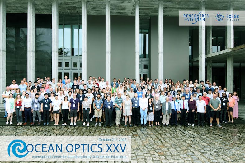
Ocean Optics 2022 Highlights
 After a four-year hiatus, the Ocean Optics Conference was held at the ICISE Center in Quy Nhon Vietnam from 2-7 October 2022. The conference was a success and welcomed a lot of new participants. Some highlights appear below:
- 160 participants from 25 countries travelled to Vietnam.
- 54 oral and 103 poster presentations provided the latest developments in theoretical marine optics, in-situ measurements, instruments development and application.
- Four pre-conference short courses supported students, early career and established researchers in development of skills for working with satellite data from NOAA and EUMETSAT, and radiative transfer modelling with Hydrolight and OSOAA.
- Three plenary speakers highlighted unique perspectives: Trần Đình Lân from the IMER institute (Vietnam) showcased the development of the oceanography in Vietnam for the past 100 years: Claudia Giardino from CNR (Italy) described the development of research over inland water and John Hedley from Numerical Optics (England) presented methods to detect changes in benthic environments.
- Ed Fry was celebrated as the most recent recipient of the Jerlov Award .
Sponsors and Major Supporters and exhibitors played a key role in the event. Exhibitors were able to promote their new technology and to engage with the participants. The new co-chair of Ocean Optics XXVI (2024) is Paula Bontempi (URI, USA) and the form to submit self-nominations for the 2024 Planning Committee is available here. The deadline to respond is November 15, 2022.
Members of the ocean colour community are also invited to share ideas for future Ocean Optics conferences by completing this short Slido Survey Responses are requested by November 15, 2022.
Publication Highlights
Wu et al. (2022) showed, for the first time, the need and importance of taking into account the entire day-night cycle of phytoplankton photosynthesis for obtaining robust estimates of Net Primary Productivity (NPP) and Integrated Primary Productivity (IPP) from satellite ocean colour data. Owing to the paucity of ship data, local, regional and global estimates of carbon fixed by phytoplankton are typically supplemented with satellite-based calculations, tremendously increasing their spatial and temporal resolution. However, despite considerable progress, accurate estimates of ocean productivity from space have not been realized because the current polar-orbiting satellites provide primary input data only once or twice a day. Here, the authors used the unique short-temporal daily measurements (8 times a day) of the Korean Geostationary Ocean Color Imager (GOCI) and the Absorption Based Productivity Model (AbPM) which incorporates the absorption coefficient of phytoplankton (aph), and the quantum yield of photosynthesis ϕ, (mol C mol photons-1) to provide vastly improved daily estimates of surface NPP and IPP that closely match those measured using radioactive carbon. The study region encompassed the optically and biogeochemically complex waters around the Korean Peninsula, which was divided into dynamic biomes based on the optical and physical oceanographic characteristics to mitigate the limited number of ϕ that we measured on board. These findings also serve as a proof of concept, and successful approach for exploiting multiple radiometric measurements from planned launches of geostationary satellites for accurate estimates of NPP and IPP.

Delineated optical biogeochemical biomes of waters around the Korean Peninsula. Pink dots superimposed on the map denote m (mol C mol quanta-1 ) estimated during the KORUS cruise (b) Phytoplankton species distribution obtained with the optical imager FlowCam® at different locations superimposed on a GOCI Chl- a map (binned for the duration of the cruise). Pie diagrams denote phytoplankton groups obtained using CHEMTAX analysis of HPLC-pigment measurements.
Burggraaff et al. (2022) have shown that the accuracy and reproducibility of consumer cameras for above-water radiometry can be improved by using RAW format images and calibrations of the spectral and radiometric response. The authors report resulting remote sensing reflectance (Rrs) accuracy of around 10% in the red, green, and blue (RGB) bands, and 2% in the RGB band ratios, similar to professional instruments and up to nine times better than existing smartphone-based methods.
The authors conclude that using RAW data, smartphones and other consumer cameras are complementary to professional instruments in terms of data quality, and offer practical recommendations for using consumer cameras in professional and citizen science.

One major obstacle in ocean color remote sensing is the presence of clouds, which might be circumvented by the use of synthetic aperture radar (SAR). In a recent study by Qi et al. (2022), about 15,000 Sentinel-1 SAR and Sentinel-2 MSI image tiles are analyzed and compared to evaluate their capacity in detecting various types of floating matters. These include macroalgae (Ulva prolifera, Sargassum horneri, Sargassum fluitans/natans), cyanobacteria (Microcystis, Nodularia spumigena, and Trichodesmium), dinoflagellates (green and red Noctiluca), organic matters (sea snots and brine shrimp cysts), and marine debris (driftwood). Of these, U. prolifera is found to be detectable in S1/SAR imagery, followed by the occasional detection of S. fluitans/natans and driftwood. S1/SAR observations are found to be able to complement those from the optical sensors in monitoring and tracking U. prolifera and S. fluitans/natans in their respective regions. One important finding in this work is that opposite conclusions may be reached if only case studies are used to prove or disprove a hypothesis, thus calling for statistical analysis to understand the sensor performance under various scenarios.
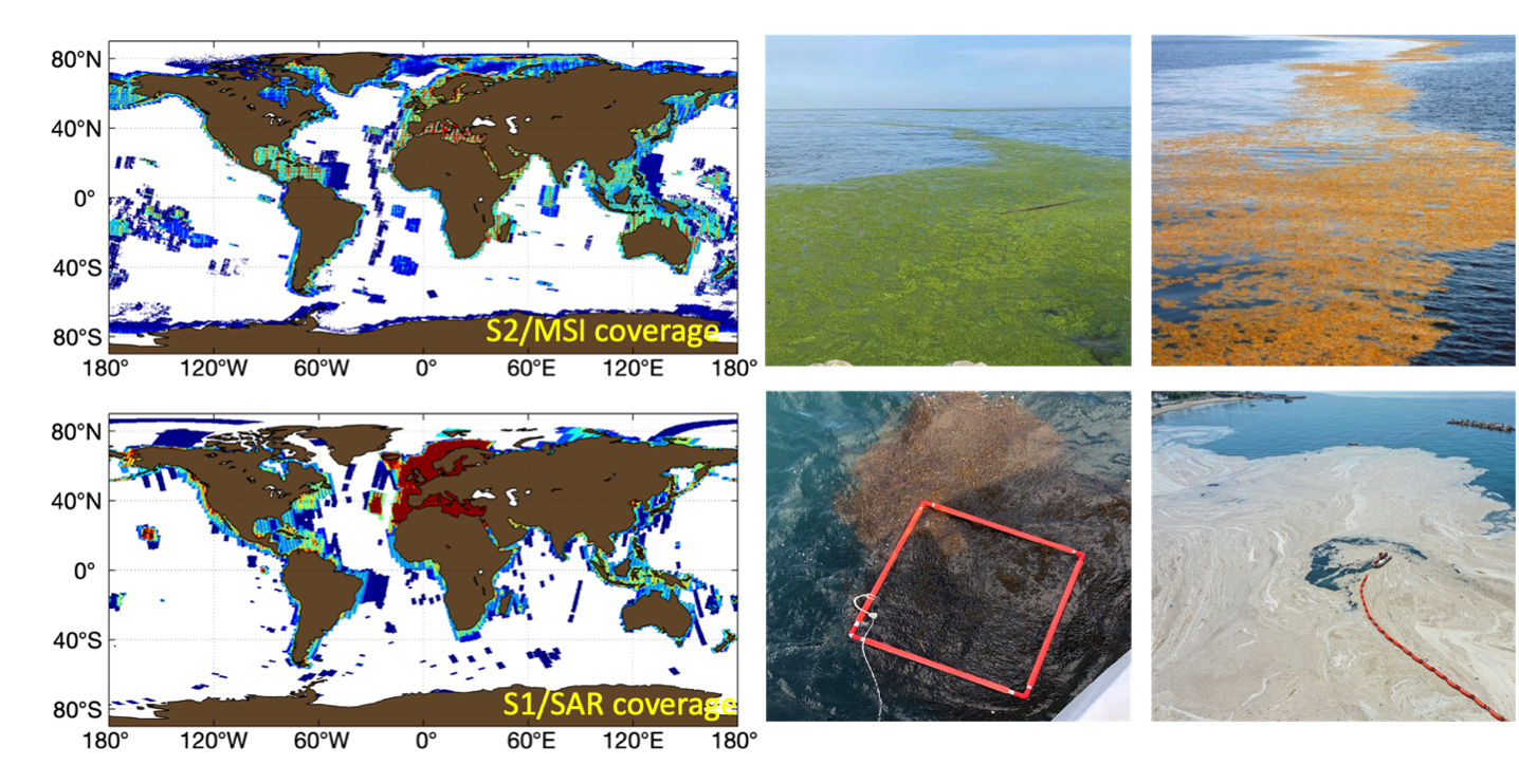
S2/MSI and S1/SAR coverage and sample photos of floating matters (Qi et al., 2022).
A new publication by Zhou et al. (2022) aims at demonstrating the high performance of the first shipborne oceanic high-spectral-resolution lidar (HSRL) and illustrates a multiple scattering correction algorithm to rigorously address the above challenges in estimating the depth-resolved diffuse attenuation coefficient, Kd, and the particulate backscattering coefficient, bbp at 532 nm. Results include vertical profiles from open ocean waters to moderate turbid waters and first lidar continuous observation of diel vertical distribution of thin layers at a fixed station. The root-mean-square relative differences between the HSRL and coincident in situ measurements are 5.6% and 9.1% for Kd and bbp, respectively, corresponding to an improvement of 2.7–13.5 and 4.9–44.1 times, respectively, with respect to elastic backscatter lidar methods. Shipborne oceanic HSRLs with high performance are expected to be of paramount importance for the construction of 3D map of ocean ecosystem.
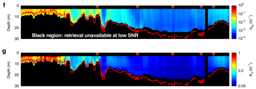
Continuous underway HSRL measurements (~800 km). Profiles of bbp(532) and Kd(432) retrieved by HSRL with 3 optical depths in red lines.
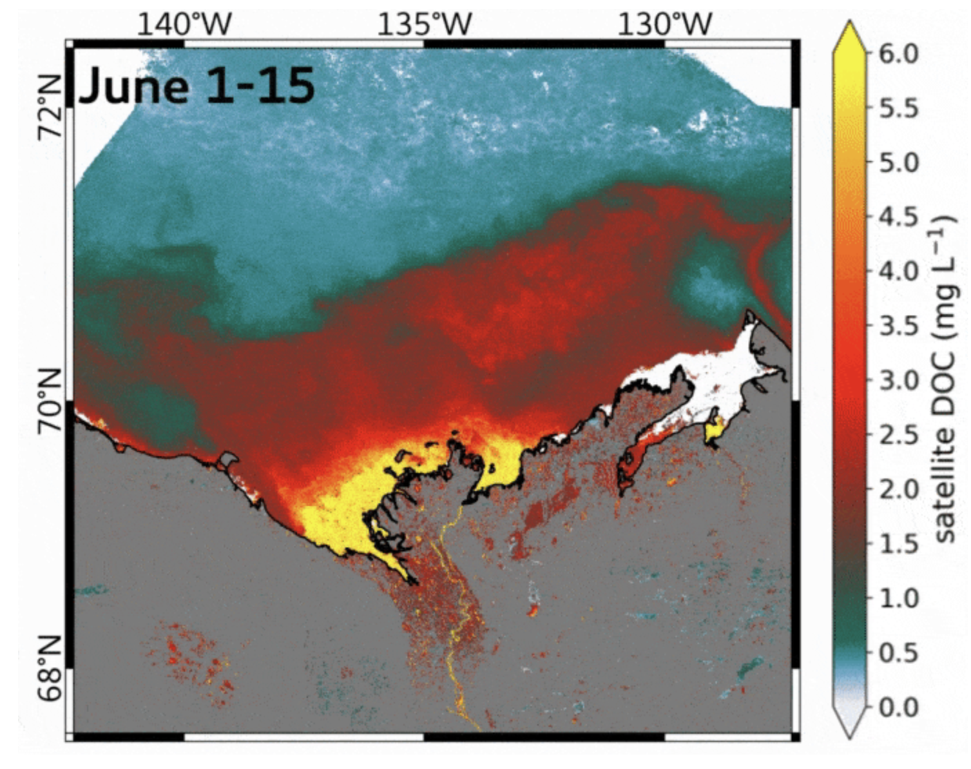
Mean surface water DOC concentration of the Mackenzie Delta – Beaufort Sea region for 1-15 June 2019. DOC concentration was retrieved using all available S-3 OLCI data (see Juhls et al, 2022 for details).
Lastly, Juhls et al. (2022) used Satellite Ocean Colour Remote Sensing to complement monitoring of land-ocean dissolved organic carbon (DOC) fluxes, detect their trends, and help in understanding their propagation in the Arctic Ocean. The results show the strong seasonal dynamics of the Mackenzie River plume and the spatial distribution of associated terrigenous DOC on the Beaufort Sea Shelf for the first time. Using a dataset collected during an extensive field campaign in 2019, the performance of three commonly-used atmospheric correction (AC) algorithms and two available colored dissolved organic matter (CDOM) retrieval algorithms were evaluated using the Ocean and Land Colour Instrument (OLCI). The evluation showed that in optically-complex Arctic coastal waters the Polymer AC algorithm performed the best. For the retrieval of CDOM, the gsmA algorithm (MPE = 35.7%) showed slightly more consistent results compared to the ONNS algorithm (MPE = 37.9%). By merging our measurements with published datasets, the newly-established DOC-CDOM relationship for the Mackenzie-Beaufort Sea region allowed estimations of DOC concentrations from SOCRS across the entire fluvial-marine transition zone with an MPE of 20.5%. The data from Sentinel-3 OLCI was used to illustrate the seasonal variation of DOC concentrations in the surface waters of the Beaufort Sea on a large spatial scales and high frequency throughout the entire open water period. Satellite-derived images of surface water DOC concentration placed the in situ observations into a larger temporal and spatial context and revealed a strong seasonal variability in transport pathways of DOC in the Mackenzie-Beaufort Sea region.
Employment Opportunities
Several new positions have been added to Employment Opportunities on the IOCCG website including:
- Ocean ecology lab assistant, NASA Goddard Space Flight Center, MD, USA
- Earth Observation Ocean Scientist, ESA-ESRIN, Frascati, Italy
- Senior Engineer (Electronics, Optics and Metocean), NASA-MarONet, Curtin University, Perth, Australia
- PhD position, University of Oldenburg, Germany
Click here for more information on these and other positions. If you would like to include a position on this page, please contact Raisha Lovindeer.
