This IOCCG news bulletin contains a summary of the latest news from the IOCCG and its sponsoring agencies, as well as the broader ocean colour community. If you would like to include an item of interest in the next IOCCG news bulletin, please contact the IOCCG Scientific Officer, Dr. Raisha Lovindeer (raisha@ioccg.org), with a cc: to Dr. Venetia Stuart (vstuart@ioccg.org). If you are having trouble receiving emails from IOCCG on your network, please see instructions on how to Whitelist “Campaign Monitor” (the IOCCG email marketing platform). Please also add raisha@ioccg.org, vstuart@ioccg.org and ioccg@ioccg.org to your list of contacts (especially important for subscribers with Gmail accounts – also check your SPAM folder).
IOCCG News
Welcome to the New IOCCG Scientific Officer
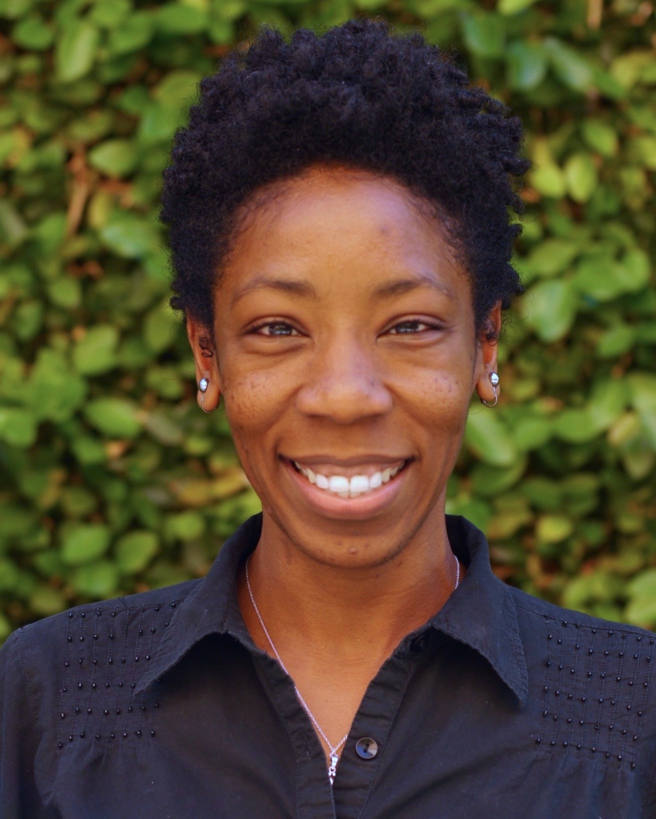 We are delighted to welcome Raisha Lovindeer into the IOCCG Project Office. She will work part-time alongside Venetia Stuart while she completes her 1-year post-doctoral position. Raisha joins us from University of California, Irvine (UCI), where she has just completed her PhD on the ecological significance of cyanobacteria pigment acclimation in the ocean. She first became acquainted with the IOCCG when she attended the 2018 Summer Lecture Series. She found the experience extremely valuable, and it led to an internship detecting cyanobacteria blooms in estuarine waters. Previously she spent several years in the public and private sector, including a position at Jamaica’s environmental protection agency, as well as managing a company, so she has a wealth of experience and strong leadership skills. We very much look forward to working with Raisha, who shares our vision of advancing ocean colour radiometry across all aquatic environments and strengthening relationships with the global ocean colour community.
IOCCG Report 20 on Harmful Algal Blooms
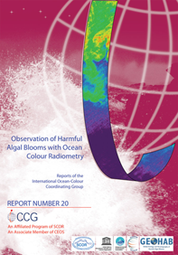 Hot off the press – IOCCG Report 20 on “Observation of Harmful Algal Blooms with Ocean Colour Radiometry” has just been published! The report, edited by Stewart Bernard, Raphael Kudela, Lisl Robertson Lain and Grant Pitcher, is the result of a working group sponsored jointly by the IOCCG as well as the GEOHAB Programme (now GlobalHAB) of the Scientific Committee on Oceanic Research (SCOR) and the Intergovernmental Oceanographic Commission (IOC) of UNESCO. We thank all the working group members for their hard work and dedication in helping to get this report finalized. A digital version of the report is now available for download from the IOCCG website at https://ioccg.org/what-we-do/ioccg-publications/ioccg-reports/. The State Key Laboratory of Satellite Ocean Environment Dynamics, Second Institute of Oceanography (China) has kindly offered to print hardcopies of the report, which is gratefully acknowledged. Hardcopies can be pre-ordered by completing the IOCCG Report Request Form.
The report contains various case studies of remote sensing of harmful algal blooms in coastal and inland waters, including cyanobacterial blooms, toxic diatom and dinoflagellate blooms, fish-killing blooms and other harmful high biomass / ecologically disruptive algal blooms. The advantages and limitations of using satellite ocean colour radiometry for HAB observations are addressed, including the inherent challenges of remote sensing in high biomass, optically complex, coastal and small inland water bodies. The report concludes with chapters on the transition from HAB ocean colour research to operational HAB monitoring systems, as well as future perspectives and recommendations.
Special Issue on Aquatic Carbon Stocks and Fluxes
IOCCG is sponsoring a special issue in the journal of Earth-Science Reviews with the theme on “Aquatic carbon stocks and fluxes: The big picture from remote sensing.”
In recent decades, significant advances have been made in quantitative assessment of carbon stocks and fluxes in aquatic systems. While a rich scientific literature exists detailing these advances, there is a lack of a compiled synthesis of developments, findings, and future directions that is accessible both to researchers in aquatic sciences and the broader scientific community. To address this shortcoming and to broadly raise awareness on the critical role aquatic systems play in the functioning of the Earth system, this special issue aims to publish invited and contributed papers that summarize the current state-of-the-science and establish a roadmap for future developments. The special issue will cover topics on carbon stocks and fluxes within a diversity of realms, including but not limited to, inland systems (lakes/rivers), tidal wetlands (marshes/mangroves), coastal and open oceans, polar regions, key interfaces (ocean/ land/ cryosphere/ atmosphere), and from regional to global scales.
Please see the full announcement (21 May 2021) of the special issue, to be published in Earth Science Reviews, with details on editorial board and submission instructions.
New IOCCG Task Force OC SVC
 The IOCCG periodically establishes semi-permanent “Task Forces” to help to facilitate international, inter-agency, collaboration on an ongoing basis. Currently, the working group on “Long-term Vicarious Adjustment of Ocean Colour Sensors” is being transformed into an IOCCG Task Force in order to provide a forum for inter-agency communication and discussion on the issue of ocean colour system vicarious calibration (SVC), since this is such an important activity for all agencies. The new task force will be co-chaired by Ewa Kwiatkowska (EUMETSAT) and Carol Johnson (NIST) and will help to coordinate SVC infrastructure development and maintenance, including NOAA maintenance of MOBY, NASA development of SVC infrastructure for the PACE mission and EU Copernicus/EUMETSAT development of SVC infrastructure for the Sentinel missions.
In Memoriam (Roland Doerffer 1947- 2021)
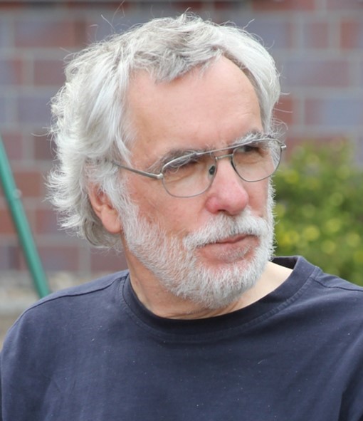 With great sadness, we announce the passing of Roland Doerffer, distinguished colleague and former IOCCG Committee member. Roland was invited to serve on the IOCCG Committee for several terms (2002-2014) because of his wealth of experience and extensive knowledge of neural network analysis and remote sensing in optically-complex waters. He was a pioneer of ocean colour remote sensing as well as an excellent teacher, and we will all fondly remember his warm but unassuming personality and his remarkable contributions to remote sensing of ocean colour. For a remembrance of his life and contributions to science see the IOCCG Announcement dated 6 April 2021. On behalf of the IOCCG Committee, we extend our deepest condolences to Roland’s family and friends.
News from NASA
SPEXone Polarimeter for NASA PACE Mission
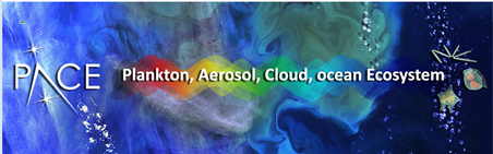 The NASA Plankton, Aerosol, Cloud, ocean Ecosystem (PACE; https://pace.gsfc.nasa.gov) mission received delivery of the flight SPEXone multi-angle polarimeter in late March 2021. SPEXone is a contribution from a consortium of organizations in the Netherlands, including the SRON Netherlands Institute for Space Research and Airbus Defence and Space Netherlands, and one of two multi-angle polarimeters to be included on the PACE observatory. SPEXone is currently ongoing final calibration at NASA Goddard Space Flight Center, after which it will be ready for future integration onto the PACE spacecraft. Briefly, SPEXone will: (1) provide continuous spectral coverage over the range 385-770 nm in 2-4 nm steps for radiance and 10-40 nm steps for degree of linear polarization; (2) collect measurements at 5 viewing angles (0, +-20, and +-58 deg); and (3) collect measurements over a +-4 deg swath (~100 km) and 2.5 km ground sample distance. Learn more about SPEXone at https://pace.oceansciences.org/spexone.htm .
News from NOAA
Dedicated JPSS VIIRS Ocean Color Cal/Val Cruises
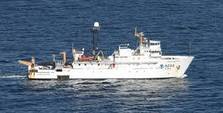
NOAA Ship Gordon Gunter (courtesy NOAA)
The 6th dedicated JPSS VIIRS Ocean Color Cal/Val cruise is now underway. The science crew is composed of researchers from NOAA, University of Puerto Rico, City University of New York, University of South Florida and Oregon State University, this year missing some of the usual participants and collaborators due to the pandemic-related travel restrictions. After several weeks of quarantine protocols and COVID-19 testing, the science crew boarded the NOAA Ship Gordon Gunter (right) and departed from Pascagoula MS. The team will chase clear skies and sample the Gulf of Mexico waters for about 10 days , including a visit to the WavCis AERONET site (below).
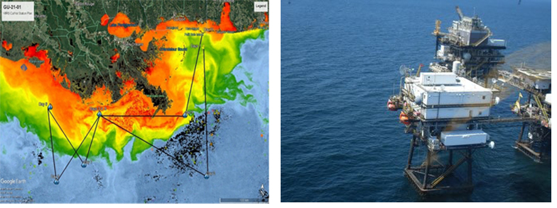
(left) General plans for cruise track overlaid on VIIRS ocean color (courtesy Sherwin Ladner, Naval Research Laboratory). (right) WavCis AERONET-OC platform
The 5th cruise report (NESDIS Technical Report #154) has been published at the NOAA Library. This report covers activities of the 5th dedicated JPSS VIIRS Ocean Color Cal/Val cruise which was completed in September 2019 off the US mid-Atlantic coast after Hurricane X and managed a record number of clear sky stations and satellite matchups compared with the prior cruises of this series. Previous NESDIS Technical Reports on the Dedicated JPSS VIIRS Ocean Color Calibration/Validation Cruise Series:
- Report #152 May 2019 doi: 10.25923/scyb-qf42
- Report #151 October 2016 doi: 10.7289/V5/TR-NESDIS-151
- Report #148 December 2015 doi: 10.7289/V5/TR-NESDIS-148
- Report #146 November 2014 doi: 10.7289/V52B8W0Z
Recent Peer Reviewed Publications from the NOAA Ocean Color Science Team
Mikelsons, K., M. Wang, X. Wang, and L. Jiang (2021). Global land mask for satellite ocean color remote sensing, Remote Sens. Environ., 257, 112356. doi:10.1016/j.rse.2021.112356
Wang, M., L. Jiang, K. Mikelsons, and X. Liu (2021). Satellite-derived global chlorophyll-a anomaly products, Int. J. Appl. Earth Observ. Geoinf., 97, 102288 (2021). doi:10.1016/j.jag.2020.102288
News from NOAA and EUMETSAT
Second International Operational Satellite Oceanography Symposium
Reminder that the 2nd International Operational Satellite Oceanography Symposium, jointly hosted by NOAA and EUMETSAT will take place virtually, 25-27 May 2021. Registration is open until 15 May 2021. The symposium will feature live, interactive sessions with a series of short oral presentations and panel discussions. Posters will be presented during breaks. All materials will be available online prior to the beginning of the symposium. Session topics include data assimilation of satellite data; coupled models using satellite data, satellite data for coastal applications, and other general applications and one session will cover operational agency plans for ocean/coastal/aquatic stakeholders. Join us.
Journal Special Issues
Ocean Observations from Geostationary Platforms
![]() While polar orbiting satellites have shown great success in capturing oceanic phenomena of global scale, geostationary satellites (e.g., COMS and Geo-KOMPSAT-2 carrying the GOCI and GOCI-II ocean colour sensors) demonstrate unique benefits in ocean monitoring, providing high observation frequencies for designated areas. The merits of geostationary platforms will also be further exploited in upcoming missions such as GEO-XO by NOAA and GLIMR by NASA. A Special Issue of the journal Remote Sensing, edited by Drs. JongKuk Choi and Wonkook Kim, endeavors to assemble novel studies that utilize advanced remote sensing technology to monitor ocean surface based upon the data from geostationary platforms. Numerous studies have already demonstrated that the geostationary platforms have great advantages in monitoring short-term variations in the ocean, such as dynamics in suspended sediments, migration of harmful algal blooms, low salinity water intrusion, and formation of oceanic eddies and filaments. For information about submitting a manuscript (deadline 31 January 2022) see Remote Sensing | Special Issue : Ocean Monitoring from Geostationary Platform (mdpi.com)
While polar orbiting satellites have shown great success in capturing oceanic phenomena of global scale, geostationary satellites (e.g., COMS and Geo-KOMPSAT-2 carrying the GOCI and GOCI-II ocean colour sensors) demonstrate unique benefits in ocean monitoring, providing high observation frequencies for designated areas. The merits of geostationary platforms will also be further exploited in upcoming missions such as GEO-XO by NOAA and GLIMR by NASA. A Special Issue of the journal Remote Sensing, edited by Drs. JongKuk Choi and Wonkook Kim, endeavors to assemble novel studies that utilize advanced remote sensing technology to monitor ocean surface based upon the data from geostationary platforms. Numerous studies have already demonstrated that the geostationary platforms have great advantages in monitoring short-term variations in the ocean, such as dynamics in suspended sediments, migration of harmful algal blooms, low salinity water intrusion, and formation of oceanic eddies and filaments. For information about submitting a manuscript (deadline 31 January 2022) see Remote Sensing | Special Issue : Ocean Monitoring from Geostationary Platform (mdpi.com)
Supplement on Ocean Observing
![]() The purpose of this supplement to the Oceanography magazine is to widely disseminate information about the many different ways in which scientists observe the ocean to improve our understanding and support the sustainable management of the ocean and its resources. The December 2021 supplement will be aligned with the priorities of the UN Decade of Ocean Science for Sustainable Development. They are seeking contributions within the following five topical areas: i) Ocean-climate nexus ii) Ecosystems and their diversity, iii) Ocean resources and the economy under changing environmental conditions, iv) Pollutants and contaminants and their potential impacts on human health and ecosystems, and v) Multi-hazard warning systems. View the full invitation letter here. If you are interested in contributing an article to this supplement, please send a letter of interest that includes a short description of your idea to Oceanography editor Ellen Kappel (ekappel@geo-prose.com).
The purpose of this supplement to the Oceanography magazine is to widely disseminate information about the many different ways in which scientists observe the ocean to improve our understanding and support the sustainable management of the ocean and its resources. The December 2021 supplement will be aligned with the priorities of the UN Decade of Ocean Science for Sustainable Development. They are seeking contributions within the following five topical areas: i) Ocean-climate nexus ii) Ecosystems and their diversity, iii) Ocean resources and the economy under changing environmental conditions, iv) Pollutants and contaminants and their potential impacts on human health and ecosystems, and v) Multi-hazard warning systems. View the full invitation letter here. If you are interested in contributing an article to this supplement, please send a letter of interest that includes a short description of your idea to Oceanography editor Ellen Kappel (ekappel@geo-prose.com).
Training on Calibration and Validation of OC Remote Sensing
![]() Despite the ongoing COVID disruption we are happy to announce that the Ocean Optics class is likely to take place this summer at the Bowdoin College, Schiller Coastal Studies Center (SCSC), Orr’s Island, Maine. This intensive four-week, cross-disciplinary, graduate-level workshop in optical oceanography is a continuation of the optical oceanography course first offered at the Friday Harbor Laboratories in 1985 and is funded by NASA. Unfortunately for all, this year we have limited the class to only US-based students and postdocs and are requesting that all participants be vaccinated. Materials from the class will be posted online at: http://misclab.umeoce.maine.edu/OceanOpticsClass2021/ where materials from previous classes can also be accessed (under ‘Resources’).
Despite the ongoing COVID disruption we are happy to announce that the Ocean Optics class is likely to take place this summer at the Bowdoin College, Schiller Coastal Studies Center (SCSC), Orr’s Island, Maine. This intensive four-week, cross-disciplinary, graduate-level workshop in optical oceanography is a continuation of the optical oceanography course first offered at the Friday Harbor Laboratories in 1985 and is funded by NASA. Unfortunately for all, this year we have limited the class to only US-based students and postdocs and are requesting that all participants be vaccinated. Materials from the class will be posted online at: http://misclab.umeoce.maine.edu/OceanOpticsClass2021/ where materials from previous classes can also be accessed (under ‘Resources’).
For application materials please see: http://misclab.umeoce.maine.edu/OceanOpticsClass2021/index.php/2021/04/21/announcement/
Upcoming Meetings,Workshops and Training
- May 4, 11, 18, 25, and June 1: Global Ocean Biogeochemistry Array (GO-BGC) virtual workshop.
- May 14, 2021: Deadline for POGO-SCOR Visiting Fellowship 2021 application.
- May 17-21, 2021: Virtual International Liège colloquium on Ocean Dynamics: Towards an understanding and assessment of human impact on coastal marine environments
- May 25-27, 2021: virtual Operational Satellite Oceanography Symposium (OSOS-2)
- May 31-2 June, 2021: European Kickoff Conference for the UN Ocean Decade, Berlin, Germany
- June 2021: OCB Summer Workshops– interactive series of virtual events throughout June.
- June 22-27, 2021: virtual 2021 ASLO Meeting 2021 – Aquatic Sciences for a Sustainable Future: Nurturing Cooperation – see session list
- June 28-30, 2021: OCB and CLIVAR Virtual Workshop on the New Global Ocean Biogeochemistry (GO-BGC) Array – Building a Community of Biogeochemical Float Data Users
- July 19-23, 2021: Optical Society’s 2020 Hyperspectral Imaging and Sounding of the Environment (virtual and in-person Vancouver, Canada).
- July 19 – August 13, 2021: NASA Sponsored Workshop on Calibration and Validation of Ocean Color Remote Sensing, Maine, USA.
- August, 23-27, 2021: Advancing Earth Observation Forum (AEO), Brisbane, Australia
- September 15-16, 2021: Second PACE Applications Workshop, virtual.
- October 11-15, 2021: Oceans from Space, 5th edition, Venice, Italy
- October 12-14, 2021: 2nd Climate Observation Conference, Darmstadt, Germany
- October 17-21, 2021: Our Coastal Futures, Southern Cross University Gold Coast, Australia
- October 25-November 7, 2021: GEO AquaWatch Meeting, Port Elizabeth, South Africa
- December 13-17, 2021: 2021 AGU Fall Meeting (New Orleans, LA)
- February 27-March 4 2022: 2022 Ocean Sciences Meeting (Honolulu, HI) – submit session proposals by May 26th
New Publications
Tilstone et al. (2021) have just published an article on the performance of ocean colour algorithms in open-ocean waters of the Atlantic. Due to their inaccessibility, the oligotrophic open-ocean gyres are under-sampled and therefore under-represented in global in situ data sets. In-water underway spectrophotometric data were collected on a suite of Atlantic Meridional Transect (AMT) field campaigns to assess the performance of Sentinel-3A (S3-A) and Sentinel- 3B (S3-B) Ocean and Land Colour Instrument (OLCI) products. Three Chl a algorithms for OLCI were compared: Processing baseline (pb) 2, which uses the ocean colour 4 band ratio algorithm (OC4Me); pb 3 (OL_L2M.003.00) which uses OC4Me and a colour index (CI); and POLYMER v4.8 which models atmosphere and water reflectance and retrieves Chl a as a part of its spectral matching inversion. The POLYMER Chl a for S-3A OLCI performed best. The S-3A OLCI pb 2 tended to under-estimate Chl a especially at low concentrations, while the updated OL_L2M.003.00 provided significant improvements at low concentrations. S-3A and S-3B OLCI Chl a products were also compared during the Sentinel-3 mission tandem phase, when S-3A and S-3B were flying 30 sec apart along the same orbit. Both S-3A and S-3B OLCI pb 2 under-estimated Chl a especially at low values and the trend was greater for S-3A compared to S-3B. The performance of OLCI was improved by using either OL_L2M.003.00 or POLYMER Chl a.
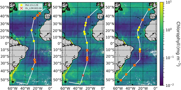
Station maps of (a) AMT26, (b) AMT27 and (c) AMT28 superimposed on Sentinel-3 OLCI Chl-a composite images. See Tilstone et al (2021) for details.
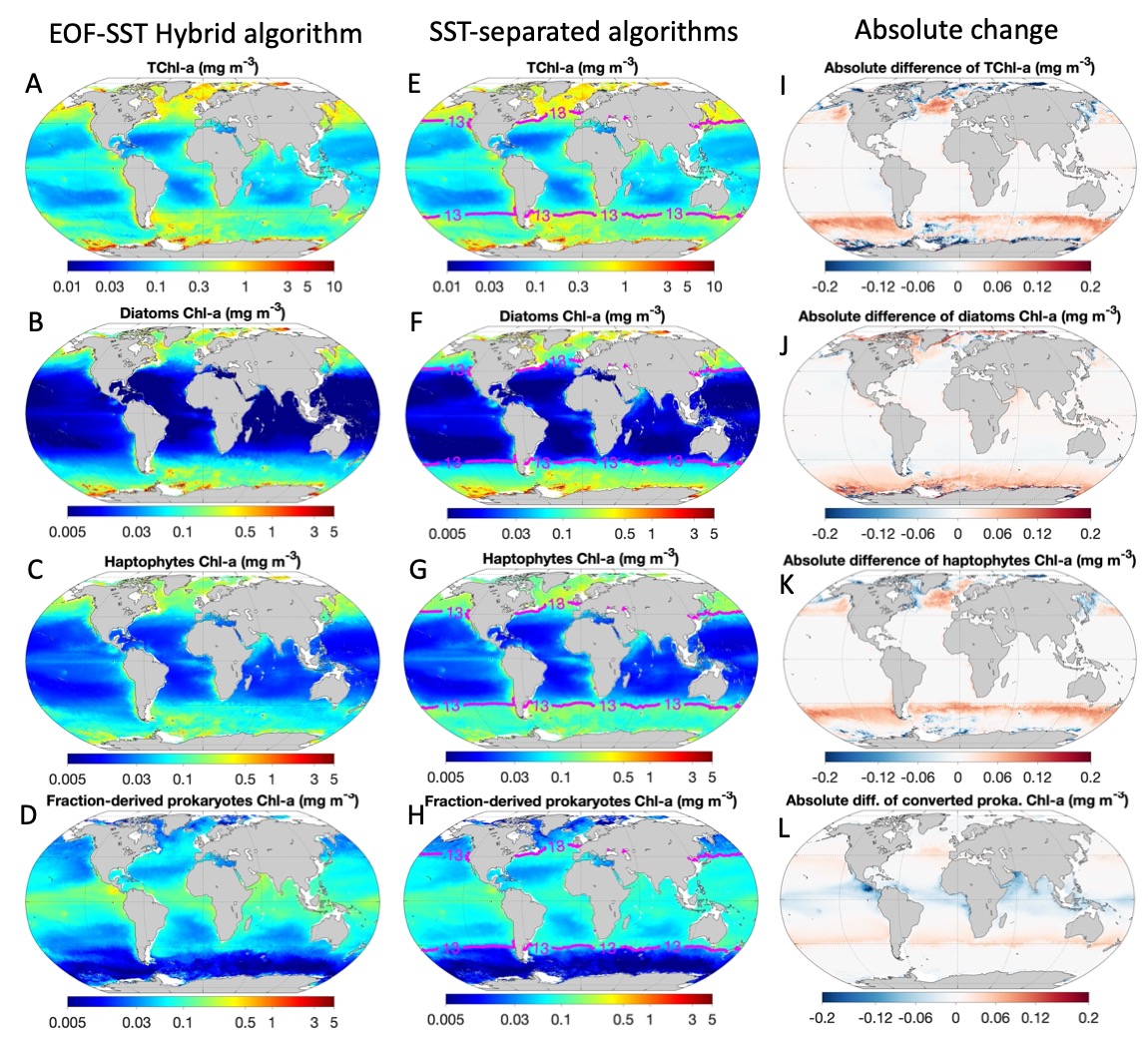
Satellite-derived estimates of annual (2011) mean surface TChl-a and Chl-a concentrations of three PFTs as examples. Panels (A-D): Estimates from EOF-SST hybrid algorithm; Panels (E-H): Combined estimates from SST-separated hybrid algorithms for SST ≥ 13°C and SST < 13°C, respectively. Panels (I-L): Absolute difference, i.e. panel (E-H) minus panel (A-D).
Also dealing with algorithms, Xi et al. (2021) have re-tuned their previously developed algorithm proposed in Xi et al. (2020) for retrieving the chlorophyll a concentration (Chl-a) of phytoplankton functional types (PFTs) from multi-sensor merged ocean colour products on a global scale. The re-tuned algorithm, referred to as EOF-SST hybrid algorithm, is improved by updating input data sets and accounting for the influence of SST on the derived PFT quantities. In addition to the Chl-a of the six PFTs (diatoms, haptophytes, dinoflagellates, green algae, prokaryotes and Prochlorococcus), fractions of prokaryotes and Prochlorococcus are also included as retrieved PFT quantities, which resulted in more accurate retrievals compared to retrieving their Chl-a directly. Matchup data are separated for low and high temperature regimes based on different PFT dependences on SST, to establish SST-separated hybrid algorithms which demonstrate further improvements in performance as compared to the EOF-SST hybrid algorithm. Finally, the per-pixel uncertainty of the retrieved TChl-a and PFT products is estimated by taking into account the uncertainties from both input data and model parameters through Monte Carlo simulations and analytical error propagation. These satellite PFT uncertainties, for the first time reported on a global scale and for spectral-based PFT retrieval approaches, provide reliable error estimates for the PFT products which allow us to better understand the product quality both in time and space. The algorithm and its method to determine uncertainties can be transferred to similar OC products until today, enabling long-term continuous satellite observations of global PFT products. The updated satellite PFT products derived from the EOF-SST hybrid algorithm will be publicly available by May 2021 (as planned) under “Ocean Products” within the frame of EU Copernicus Marine Environment Monitoring Service (CMEMS).
Several validation approaches with different quality checking and spatiotemporal collocation criteria are used by the Ocean Colour Radiometry community. In a recent publication, Concha et al. (2021) performed several matchup analyses using a common reference dataset of automated radiometry and satellite data from Sentinel-2/MSI and Sentinel-3/OLCI. They found that the number of matchups and validation metrics differ between approaches and provide a different “impression of accuracy”. As an example, of the match-ups obtained with AERONET-OC and Sentinel-3/OLCI data from two validation approaches, some negative values passed both protocols, with the Zibordi et al. (2009) (Z09) approach accepting more negative values than the Bailey and Werdell (2006) (BW06) approach, which in turn accepted more outliers, both positive and negative values. This leads to BW06 producing more match-ups but Z09 producing better validation statistics.
When the data from all stations are considered, the validation metrics for both protocols present similar spectral behaviours but with dissimilar magnitude, and most individual stations had a similar spectral shape and magnitude, with a few exceptions (see paper for details). These differences do not suggest that there is one validation protocol that performs better than the other, but it implies that accuracy reported in different studies may not always be directly comparable. For the selection of the suitable protocols, we urge the community to address explicitly the following questions:
- What are the most relevant criteria for selecting the validation protocol?
- Is it better to have more match-ups with a more relaxed filtering criteria or to select the best case scenarios, and therefore, fewer match-ups?
- Are we inducing a bias by showing the best results and hiding the inferior results?

Sentinel-3/OLCI match-ups for the 412.5 and 490 nm bands from the validation protocols used by Bailey and Werdell (2006) (x) and Zibordi et al. (2009) (+) for five AERONET-OC stations (see Concha et al. (2021) for details.
In another new publication, Wang et al. (2021) recently published a water colour Forel-Ule Index (FUI) monthly dataset for global large lakes (N = 1049) based on MODIS observations during 2000-2018. In recent decades, lakes around the world have experienced dramatic changes in water quality, under pressure from both climate change and anthropogenic activities. However, acquiring consistent water colour products for global lakes has been a challenge. The FUI is a useful comprehensive indicator to show the water colour variability and water quality change in both inland waters and oceans. This paper presents the satellite data processing methods for water-leaving reflectance correction, lake water body identification, FUI retrieval, as well as monthly and yearly FUI calculations. Preliminary results from this dataset found that 36.4% of the lakes had an increasing trend in water colour FUI during the past two decades, and most of the lakes were located at cold regions around the world. We expect this global dataset will be valuable to studies in search of the drivers of global and regional lake colour change, and the interaction mechanisms between water colour, hydrological factors, climate change, and anthropogenic activities.
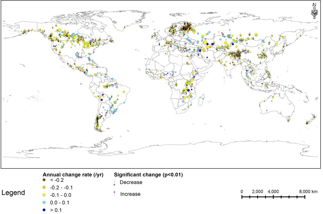
Annual rate of change of FUI from 2000–2018 over lakes in this dataset. Circle size is proportional to the lake surface area.
Lastly, also dealing with the Forel–Ule index , Pitarch et al. (2021) report on the release of a satellite dataset (1997–2018) consisting of global maps of the Forel–Ule index, hue angle and Secchi disk depth. The use of these products for environmental studies has been rising, but no public datasets exist thus far, forcing scientists to calculate them individually, thereby discouraging non-experts. The release of this dataset hopes to eliminate redundant efforts within the community to estimate water transparency and colour from satellite measurements. Depending on the reception and user needs, future releases using other temporal and spatial resolutions are foreseen.
Data are presented as monthly aggregates at a spatial resolution of ∼4 km at the Equator and are available at PANGAEA (https://doi.org/10.1594/PANGAEA.904266). Two smaller and easier-to-handle test datasets have also been produced: a global dataset at 1o spatial resolution and one for the North Atlantic at 0.25o resolution.
Since single sensor lifetimes are too short to be used in climate studies, the multi-sensor time series of merged remote-sensing reflectance data produced by ESA’s Ocean Colour Climate Change Initiative (OC-CCI), was used to derive the former quantities. Products described in this article have the exclusive advantage of being linkable to in situ historic observations thus enabling the construction of very long time series. For adventurous users, the computer code for the generation of the Forel–Ule index, hue angle and Secchi disk depth from a given remote-sensing reflectance is also available at: https://doi.org/10.5281/zenodo.4439646 and can be easily set in loop mode for batch calculations.

Mean Secchi disk depth series in the period 1997 – 2018
Employment Opportunities
Several new positions have been added to Employment Opportunities on the IOCCG website including:
- Postdoctoral Scholar in Optical Remote Sensing – University of South Florida, USA
- Ocean Observations Technical Coordinator – Villefranche-sur-mer, France
- Research Engineer Position in Oceanic Lidar Applications, LOG, Wimereux, France
- NASA PACE Applications Deputy Coordinator position, NASA Goddard Space Flight Center
- Earth Observation Researcher, Royal Belgian Institute of Natural Sciences
- Postdoc Position in Ocean Remote Sensing, University of Victoria, BC, Canada
- Satellite Remote Sensing and Geomatics Specialist, Arctus Inc., Rimouski, QC, Canada
- Internal Research Fellow in EO and Ocean Science, ESA, Frascati, Italy
- Post-Doctoral Associate, Old Dominion University, USA
For more information on these and other positions see http://ioccg.org/resources/employment-opportunities/.
