News from the IOCCG
IOCS-2017 Meeting
Record numbers of participants have registered for the 2017 International Ocean Colour Science meeting (IOCS-2017), which will take place from 15 – 18 May 2017 in Lisbon, Portugal. The meeting is being convened by the IOCCG in partnership with, and thanks to sponsorship from the European Commission, EUMETSAT, ESA and NASA, with additional support from IPMA, Airbus and Thales Alenia Space which is gratefully acknowledged.
Nine breakout workshops promise to have very inspiring talks, addressing major challenges and providing community consensus on a wide range of current critical issues such as hyperspectral remote sensing, active remote sensing, multi-water algorithms and retrieving carbon from ocean colour radiometry, to mention but a few. Seven prominent keynote speakers will provide stimulating talks, and the Copernicus, NOAA and NASA sessions will inform participants of the latest agency developments related to ocean colour radiometry, along with presentations from international space agency representatives (see abbreviated agenda). Three poster sessions will allow participants to present their research and converse with professional colleagues (see poster abstracts on the meeting website). The Proceedings of the 2017 IOCS Meeting will be published online after the meeting and will including the keynote abstracts, agency reports and the main recommendations from the breakout workshops.
New IOCCG Committee Members
 One of the requirements of being an Affiliated Program of SCOR is the regular rotation of IOCCG Committee members. Three scientific committee members officially rotated off the Committee at the end of the IOCCG-22 meeting including Heidi Dierssen (U. Connecticut Avery Point, USA), Taka Hirata (Hokkaido University, Japan) and Andrew Tyler (University of Stirling, UK). They are sincerely thanked for their hard work and valuable contributions over the past few years. We would also like to extend a warm welcome to our new IOCCG Committee members Chuanmin Hu (U. South Florida, USA), Frédéric Melin (JRC, Italy) and Wonkook Kim (KIOST, Korea).
The IOCCG Chair was officially handed over from Stewart Bernard (CSIR, South Africa) to Cara Wilson (NOAA/NMFS, USA). We welcome Cara onto the IOCCG Executive Committee, and extend our heartfelt thanks to Stewart Bernard for skillfully guiding the IOCCG Committee over the past three years.
New IOCCG Working Group
At the IOCCG-22 Committee meeting, a proposal for a new working group addressing the “Long-term Vicarious Adjustment of Ocean Colour Sensors” was approved. The working group will be chaired by Christophe Lerebourg (ACRI-ST, France), and aims to provide guidelines on the best practices for system vicarious calibration (SVC) of satellite ocean colour sensors from various missions. Vicarious calibration refers to techniques that make use of specific sites (e.g., MOBY and BOUSSOLE buoys) for the post-launch calibration of sensors. All satellite ocean colour missions rely on system vicarious calibration using ground-truth measurements to meet the requirements for climate quality data. See Current Scientific IOCCG Working Groups for further information about this, and other IOCCG working groups.
NASA PACE Mission
 The NASA PACE mission will continue its formulation activities for the current United State Federal Fiscal Year 2017. PACE’s advanced technologies will provide unprecedented insight into Earth’s ocean and atmosphere, which impact our everyday lives by regulating climate and making our planet habitable. Data from the PACE mission will focus on advanced and continuity observations of ocean biology, biogeochemistry, and ecology, as well as aerosols and clouds. Novel uses of PACE data – from identifying the extent and duration of harmful algal blooms to improving our understanding of air quality – will result in direct economic and societal benefits. By extending and expanding NASA’s long record of satellite observations of our living planet, the PACE mission will take Earth’s pulse in new ways for decades to come.
The PACE project is currently focused on the detailed error budgets to meet radiometric performance requirements and geolocation accuracy for PACE’s Ocean Color Instrument (OCI), in preparation for an upcoming formulation review. Please see the PACE website (https://pace.oceansciences.org/home.htm) for further information on NASA’s PACE mission.
News from ESA
Sentinel-2B Launched
The European Union’s Sentinel-2B satellite was successfully launched in March 2017, doubling the coverage of high-resolution optical imaging in the Sentinel-2 mission and advancing the Copernicus environmental monitoring programme. This is the second of the twin constellation optical satellites offering a high spatial resolution of 10 m for the visible bands. Every five days, the satellites jointly cover all land surfaces, large islands, and inland and coastal waters between latitudes 84°S and 84°N, optimising global coverage and data delivery. Information from the Sentinel-2 mission is helping to improve agricultural practices, monitor the world’s forests, detect pollution in lakes and coastal waters, and contribute to disaster mapping.
Sentinel-3B, carrying the OLCI ocean colour sensor, will be added to the constellation in the coming months, and like Sentinel-2B it is the second in a twin satellite constellation. The Sentinel-3 pair will provide global coverage every two days. The OLCI instrument measures reflected solar radiation from the Earth’s surface and clouds simultaneously in 21 spectral bands. OLCI products are available at two spatial resolutions: Full Resolution (FR) at ~300 m, and Reduced Resolution (RR) at ~1.2 km.
Ocean Remote Sensing Training Course
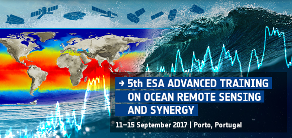
The European Space Agency (ESA) is organising an advanced Remote Sensing Training Course from 11-15 September, 2017 in Porto, Portugal. The course is devoted to training the next generation of Earth Observation (EO) scientists to exploit data from ESA and operational EO Missions (e.g. Copernicus Sentinels) for science and application development. Research scientists and students from European countries and Canada are invited to apply to the 5-day course, and participants from all other countries are welcome to apply but are subject to availability.
The course will include theoretical principles and application of ocean colour radiometry, infrared and passive microwave radiometry, biogeochemical, sea surface temperature, and sea surface salinity retrievals; theoretical principles and application of synthetic aperture radar and radar altimetry; and hands-on exercises using SAR, optical, infrared, passive microwave, and altimeter data, tools/toolboxes and methods for the exploitation of EO satellite data in synergy over the ocean. For further details see the full announcement on the ESA website.
International Workshop on Sentinel-3A Validation
An International Workshop on Sentinel-3A validation will take place from 20 – 21 June 2017 in Plymouth, UK. The workshop will address the following four themes:
- Fiducial reference measurement methods and protocols
- Ocean colour validation (Sentinel-2A & 3A),
- Sea surface temperature validation (Sentinel-3A),
- Validation of upper ocean dynamics (Sentinel-1A),
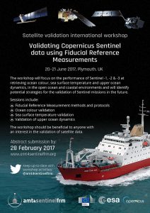
The workshop should be beneficial to anyone with an interest in the validation of satellite data, and papers from the workshop will be published in a remote sensing journal special issue (submitted by September 2017). Further details of the AMT4SentinelFRM Workshop, including a list of confirmed speakers, can be found on the AMT4SentinelFRM consortium website, or by clicking on the leaflet to the right.
ESA FRM4SOC Workshop
The Fiducial Reference Measurement for Satellite Ocean Colour (FRM4SOC) project held an international workshop in February this year to evaluate the options for future European Ocean Colour Radiometry Vicarious Calibration (OCR-VC) infrastructure. The main objective of the workshop was to bring together world experts in optical radiometry to discuss future development of System Vicarious Calibration (SVC) infrastructure in Europe to ensure the highest possible data quality from the Copernicus Sentinel missions. Specialists from many institutions around the world including Germany, Italy, Canada, South Korea, France, USA, UK and Ireland attended the workshop.
Ocean colour remote sensing relies on highly precise and accurate in situ measurements of the optical properties of the oceans, the so-called Fiducial Reference Measurements (FRM), to optimize reliability of the satellite data, through indirect calibration, i.e., vicarious calibration. At the workshop, special attention was paid to existing reference sites for SVC including MOBy (the Marine Optical Buoy) deployed off the Hawaiian coast since 1996, and BOUSSOLE (Buoy for the acquisition of long-term optical times series) deployed in the Ligurian Sea since 2004, to review the systems and learn from their experiences. The two buoys are currently being refreshed to better respond to the new challenges of operational ocean colour remote sensing. In addition, new emerging techniques based on autonomous profiling floats were also reviewed as they offer a great potential for both vicarious calibration and data validation. The conclusions and report from the workshop will be released soon – presentations from the workshop are already available on the FRM4SOC website.
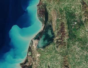
Karavasta Lagoon, Albania from the first acquisition by Sentinel-2B on 15 March 2017 (Credit ESA). See ESA website for high resolution image.
Copernicus Training Workshop
 EUMETSAT is organising a training workshop entitled “Using the Copernicus Marine Data Stream for Ocean Applications” on behalf of the European Commission as part of the Copernicus Programme. The workshop will focus on data from the Ocean and Land Colour Imager (OLCI) and the Sea and Land Surface Temperature Radiometer (SLSTR), both onboard the Sentinel-3 satellite.
Participants will develop skills in using data from EUMETSAT’s Copernicus Data Stream for oceanographic applications and should have some prior experience working in SNAP and/or a scripting language such as R (or similar). This is a blended course with an online phase (21 – 25 August 2017) prior to the classroom phase (4 – 8 September 2017), which will take place at IODE in Oostende, Belgium. Please see the announcement on the EUMETSAT website for further information and registration details. Application deadline: 7 June 2017. Applications will open soon for a similar training workshop in Accra, Ghana to be held later in the year.
News from NOAA
STAR/JPSS Annual Science Meeting
 The 2017 NOAA Center for Satellite Applications and Research (STAR) and the Joint Polar Satellite System Annual Science Meeting will be held 14-18 August 2017 at the NOAA Center for Weather and Climate Prediction Center in College Park, MD, USA. As the launch of JPSS-1 approaches, the theme of the fourth annual meeting will be “The Future with JPSS”. Information on the agenda, registration, logistics, and poster session will be released in the upcoming weeks at https://www.star.nesdis.noaa.gov/star/meeting_2017JPSSAnnual.php. This meeting is free and open. Attend in person, or remote access via WebEx. Please email Veronica Lance with your interest or questions.
NOAA Dedicated VIIRS Cal/Val cruise
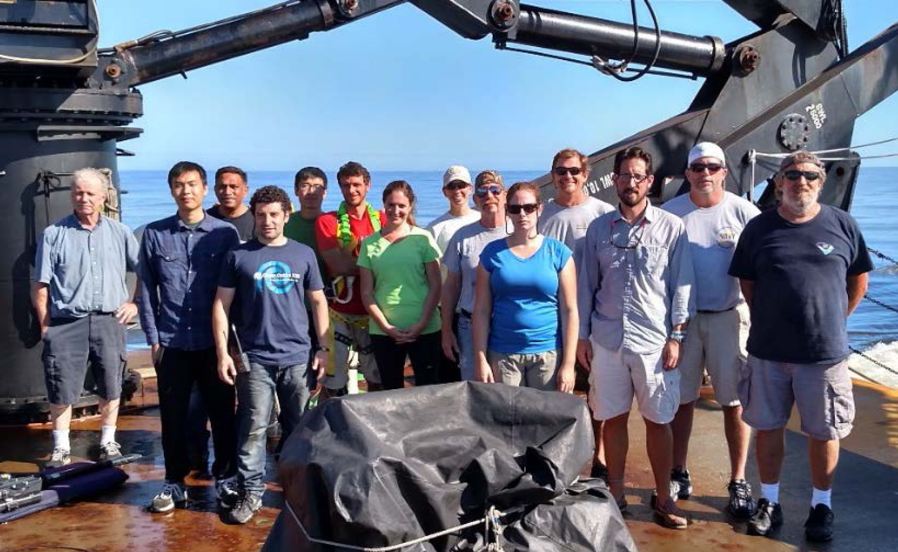
The next NOAA Dedicated VIIRS Cal/Val cruise is being planned for Spring 2018. A NOAA Technical Report is in progress to document activities of the October 2016 cruise which took place on the heels of Hurricane Matthew (East Coast, US). Two prior NOAA VIIIRS cruises took place in November 2014 (Ondrusek, et al. 2015) and December 2015 (Ondrusek, et al. 2016).
In Memoriam
We are deeply saddened to pass on the news of two colleagues from the ocean colour community who recently passed away: Dr. Charles (Chuck) Trees, from the NATO Undersea Research Centre (Italy) and former program manager at NASA, and Dr. Motoaki Kishino, a researcher working on the Japanese OCTS and GLI sensors. The IOCCG sends their deepest condolences to their families and friends.
Chuck was a vibrant, smiling member of the ocean colour community and a great research scientist. He was involved in ocean colour research for many years and also served as an IOCCG Committee member from 2001 – 2003. He was a key player in the field of ocean colour radiometry and made many invaluable contributions that were pivotal in the development of the field.
Motoaki Kishino (Tokyo University of Marine Science and Technology) worked energetically in the field of ocean optics research since the early 1980’s. His contributions towards ocean colour remote sensing, specifically research centered on the Japanese OCTS and GLI satellite sensors, resulted in a large number papers with over 2000 citations. His research focused on the bio-optical properties of water masses and development of in-water algorithms for the OCTS and GLI sensors. The passing of both colleagues is a great loss for science and the ocean colour community.

New Publications
Illustration of phytoplankton diversity as found in nature (see paper for full details).
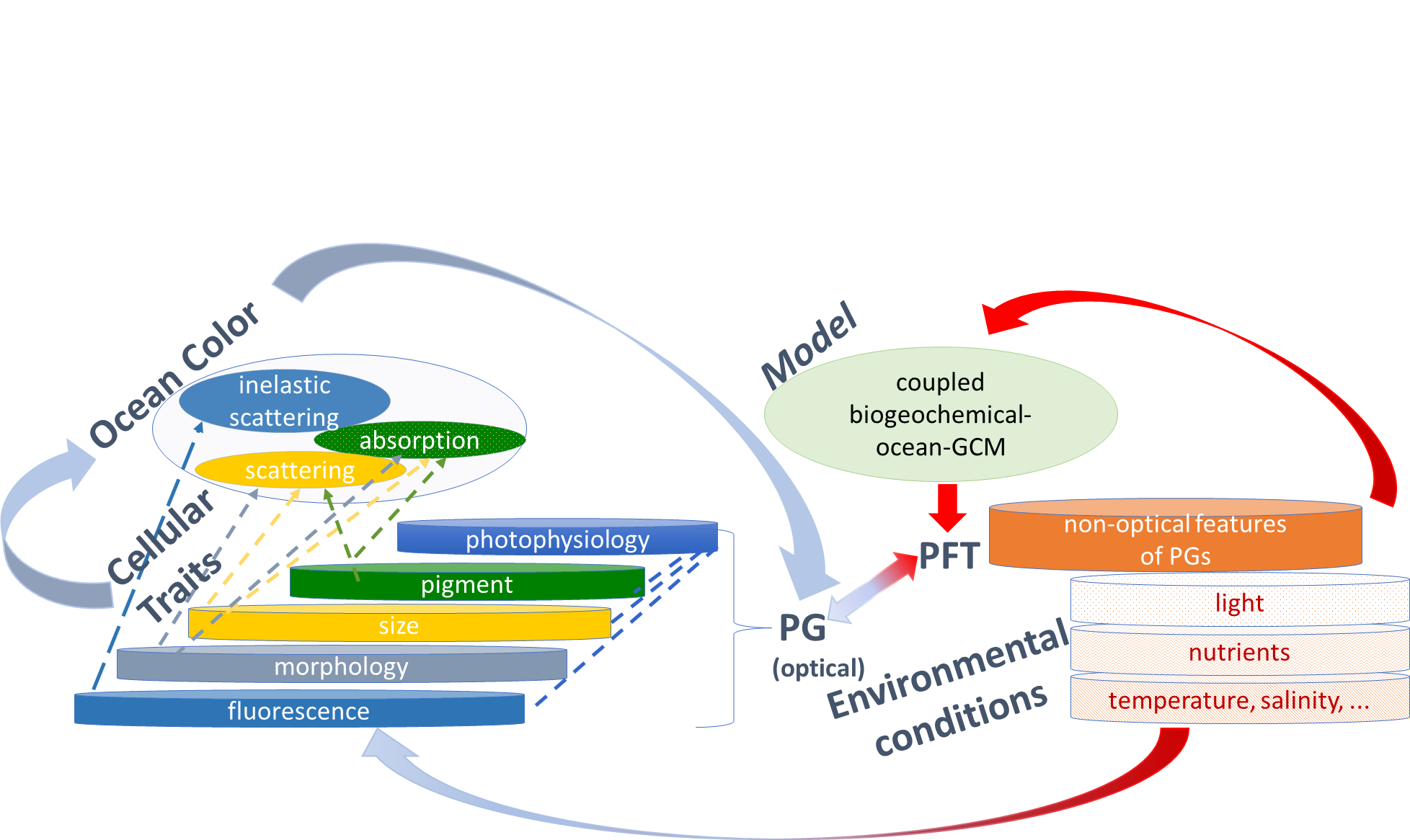
Several new publications have been added to the IOCCG Recent References list including a paper by Astrid Bracher et al. (2017) entitled “Obtaining Phytoplankton Diversity from Ocean Color: A Scientific Roadmap for Future Development”. Together with 21 scientists from 18 research institutions a scientific roadmap was developed which identifies user needs, summarizes the current state of the art, and pinpoints major gaps in long-term objectives to deliver space-derived phytoplankton diversity data that meets the user requirements. Major gaps in using ocean colour to estimate phytoplankton community structure were identified as: a) the mismatch between satellite, in situ and model data on phytoplankton composition, b) the lack of quantitative uncertainty estimates provided with satellite data, c) the spectral limitation of current sensors to enable the full exploitation of backscattered sunlight, and d) the very limited applicability of satellite algorithms determining phytoplankton composition for regional (especially coastal or inland) waters. Recommendation for actions include: i) an increased communication and round-robin exercises among and within the related expert groups, ii) the launching of higher spectrally and spatially resolved sensors, iii) the development of algorithms that exploit hyperspectral information, and iv) techniques to merge and synergistically use the various streams of continuous information on phytoplankton diversity from various satellite sensors’ and in situ data to ensure long-term monitoring of phytoplankton composition.



 The sixth International Ocean Colour Science (IOCS) meeting will take place in Darmstadt, Germany from 1 – 4 December 2025, hosted by EUMETSAT and ESA with support from other agencies.