
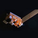
| AGENCY: | KARI/KORDI |
| SATELLITE: | GEOKompsat-2B |
| Launch Date: | 18 February 2020 |
| SWATH (km): | 2500 x 2500 |
| RESOLUTION (m): | 250 |
| # OF BANDS: | 13 |
| SPECTRAL COVERAGE(nm): | 380 – 900 |
Satellite Data
GOCI-II data (pre-processing standard data, Level 1) can be down loaded from the Korea Hydrographic and Oceanographic Agency (KHOA) at: http://www.khoa.go.kr/nosc/intro/noticeList.do
KHOA plans to integrate marine data, e.g., distribution of Sargassum horneri into map-based services and continue to expand the services utilizing satellite information. In the future, it will also provide satellite information services to cope with issues such as red tide and oil pollution detection.
GOCI Presentations and Links
- The status and initial validations of GOCI-Ⅱ. Jong-Kuk Choi (NOSC/KOSC). IOCCG-26 meeting (June 2022).
- GeoKompsat-2 eoPortal
- First Release of the Ocean Color Images of the Seas around the Korean Peninsula taken by Cheollian-2B
- “The Eyes of Space”: Cheollian 2B satellite to begin providing marine satellite images
- KIOST agency report. Joo-Hyung Ryu (KIOST), IOCS-2019 meeting
- GOCI and GOCI-II presentation – Young-Je Park (KIOST), keynote address, IOCS-2019 meeting.


