Coastal Zone Colour Scanner
Click on an image to see the full-sized version. Images courtesy of NASA’s Goddard Earth Sciences Data & Information Services Center.


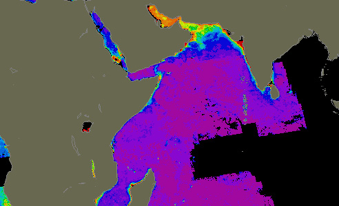
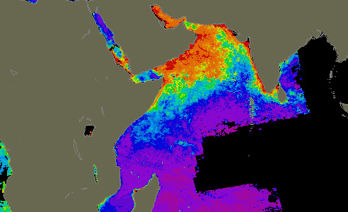
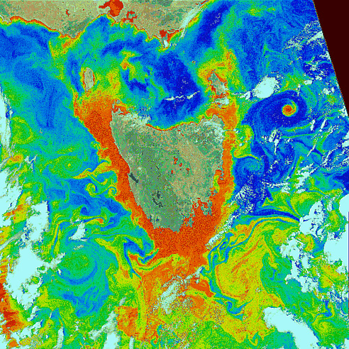
Since the CZCS mission directed much of the instrument’s observing time to the coastal zone, some of the most visible features are the interface where fresh water encounters salt water – where rivers meet the sea. The influx of fresh water (frequently laden with sediments and organic matter) into the oceans induces a variety of physical, chemical, and biological phenomena that show up clearly in many CZCS images. The CZCS image shown here, acquired on October 9, 1984, highlights the plume of sediment discharging into the Adriatic Sea from the mouth of the Po River, just south of Venice, Italy.

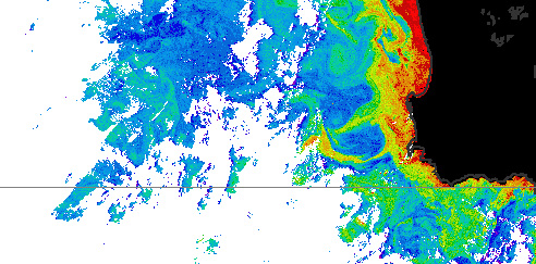
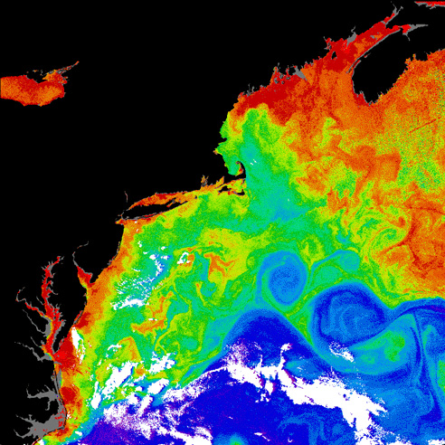
CZCS image of the Gulf Stream and northeastern coast of the United States. Several large Gulf Stream warm core rings are visible in this image, as are the higher productivity areas near the Chesapeake and Delaware Bays. To the northeast, part of the Grand Banks region near Nova Scotia is visible. Despite the high productivity of this region, overfishing caused the total collapse of the Grand Banks cod fishery in the early 1990s.


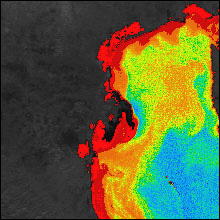
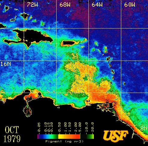
CZCS composite image of the eastern Caribbean Sea for October 1979, showing the spatial extent of the Orinoco River plume of induced high productivity that occurs during the summer rainy season. (Image courtesy of Dr. Frank Muller-Karger, University of South Florida Remote Sensing Laboratory.)
