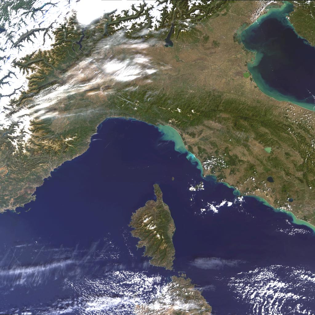
 (Click on image to enlarge) This MERIS image centres over Northern-Central Italy and Corsica. (Click on image to enlarge) This MERIS image centres over Northern-Central Italy and Corsica.
Corsica is the fourth largest island in the Mediterranean Sea
after Sicily, Sardinia, and Cyprus and is part of the French Republic.
The island has an area of 8,682 square kilometres and a largely
mountainous landscape.
The snow-covered Swiss Alps and Northern Central part of Italy
can be clearly seen in the top corner of the image. Further east
is the Venetian Lagoon and the city of Venice. The saltwater lagoon
stretches along the shoreline between the mouths of the Po (south)
and the Piave (north) Rivers. The Venetian Lagoon has a surface
area of around 550km². It is around 8 per cent land, including
Venice itself and many smaller islands, and about 11 per cent
water, or canal as the dredged channels are called. About 80 per
cent is mud flats and salt marshes. The light green colour of
the sea in the lagoon and along the Adriatic coast is likely to
be the result of the high amount of sediments deposited |
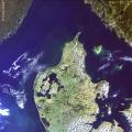
 (Click on image to enlarge) Here we see the English Channel. The Strait of Dover is the narrowest
point, only 34 km (21 miles), from Dover to Cape Gris-Nez. In the
upper part of the image most of the southern part of England can
be observed, from Plymouth to Margate on the coast-line and from
Bristol to London (large bright area). The light green-bluish colours
in the sea (Goodwin Sands area) indicate shallow waters and increased
sedimentation in the area. On the opposite side of the channel are
the French regions of Brittany and Lower Normandy. To the left of
Lower Normandy are the British islands of Jersey and Guernsey. Bands
7, 5 and 2, corresponding to visible light, were used to create
this image (Click on image to enlarge) Here we see the English Channel. The Strait of Dover is the narrowest
point, only 34 km (21 miles), from Dover to Cape Gris-Nez. In the
upper part of the image most of the southern part of England can
be observed, from Plymouth to Margate on the coast-line and from
Bristol to London (large bright area). The light green-bluish colours
in the sea (Goodwin Sands area) indicate shallow waters and increased
sedimentation in the area. On the opposite side of the channel are
the French regions of Brittany and Lower Normandy. To the left of
Lower Normandy are the British islands of Jersey and Guernsey. Bands
7, 5 and 2, corresponding to visible light, were used to create
this image |
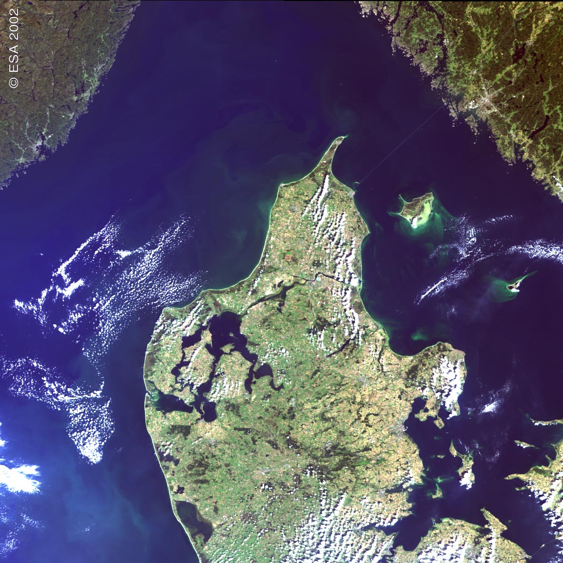
(Click on image to enlarge)Northern Denmark is shown here. Clearly seen in
the eastern part of the country is the expanse of water, Limfjorden,
with the town of Alborg to the north east of the fjord. Further
south along the east coast is the city of Arhus. Looking at the
image in more detail, in the southeast corner, the new bridge
over the Store Baelt between the islands of Fyn and Sjaelland,
linking Copenhagen to the mainland can be seen. The islands of
Laeso and Anholt off the east coast in the Kattegat are also visible.
The bright green colour off the south east of Laeso and the west
of Anholt is likely to be suspended sediment; a lot of sedimentation
takes place in this particular channel. |
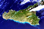
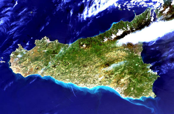
(Click on image to enlarge)
MERIS image of Sicily, Italy taken on March 23, 2002. |